
![]()
As part of this exploratory study, we were interested in mobile LIDAR acquisition for applications in natural or urban environments. The Leica solution was selected and tested with the help of the Leica Geosystem representative from Montpellier.
Brief description of the device
The Leica Pegasus backpack scanner (BLS) is a professional solution for scanning closed or open environments, transportable backpack, combining optical cameras, scanner LIDAR, inertial sensors and location system. It produces synchronized geo-referenced data: optical information is projected onto the LIDAR point cloud.
 The Pegasus Laser backpack: a 13 kg transportable platform with 6 hours autonomy including a GNSS sensor, a Lidar sensor, two inertial sensors, 5 digital cameras, 1 computer; it is controlled by a tablet. Leica’s emphasis is on the ergonomics of the device and the protection of its various components. All the equipment is packed in a metal box to facilitate all types of transport in complete safety.
Pegasus data is manipulated by the Leica Map Factory (LMF) software suite, specialized in mapping project planning. Developed as a plugin for the ArcGIS application, LMF includes an acquisition driver, post-processing and labelling modules for the acquired data and a viewer.
First contact
An itinerary on the commune of Beaulieu is chosen for this first experiment. The path followed is more or less cleared, which makes it possible to properly evaluate the handling of the bag in a natural environment. Despite these 13 kilograms, the bag is compact enough to go everywhere, and this despite the bushes / shrubs a little « invasive ».
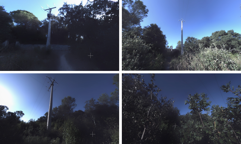
A route in a natural environment: Hemispherical reconstruction from the 5 optical sensors located behind the BLS Pegasus. Top left, starting point; top right, followed by the trail along the line; bottom left, intersection of lines; bottom right, followed by the off-trail line. Note the over/underexposed areas of reconstructions due to the orientation of the sun.
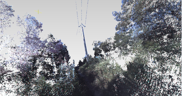
The laser data: 3D view of the point cloud corresponds to the spherical image in fig. 16-above-right. Color information is projected onto each point of the cloud.
The processing is performed with the 3DReshaper application dedicated to the processing of point clouds regardless of their origin: 3D laser scanners or air or ground photogrammetry. It covers all the needs inherent to cloud and 3D mesh processing, in particular in terms of data segmentation, noise reduction, sampling.

3DReshaper – Beaulieu – classification by nature of objects: View MVC of 3DRehaper of a scene containing a pylon (blue), cables (black) and coloured vegetation according to a height scale. On the top left, the « textual » selection module; in the center, 3D representation of the segmented scene, totally interactive. On the right, the adopted color scale and its metric.
Conclusion
The equipment is well adapted to field work, easy to handle and relatively light in the end. Data are available in many formats, with sufficient accuracy for biomass estimates. All that remains is to find projects requiring this type of platform!
Acknowledgements
We thank Raphaël GOUDARD (Leica-Geosystems) for his availability and diligence.
Contact